Visual Asset Strategic Tools. Capture Building Information for Building Life Management. Open Source/Low Cost Technology Solutions for you to control your buildings
Part 2. At the end of part 1 I was left with openMAINT not recognising postGIS. At the end of part 2 I have the map in openMAINT, but no building icon on the map, or plan of building either, but there is a progression. After configuring openMAINT as per the CMDBuild documentation, I decided
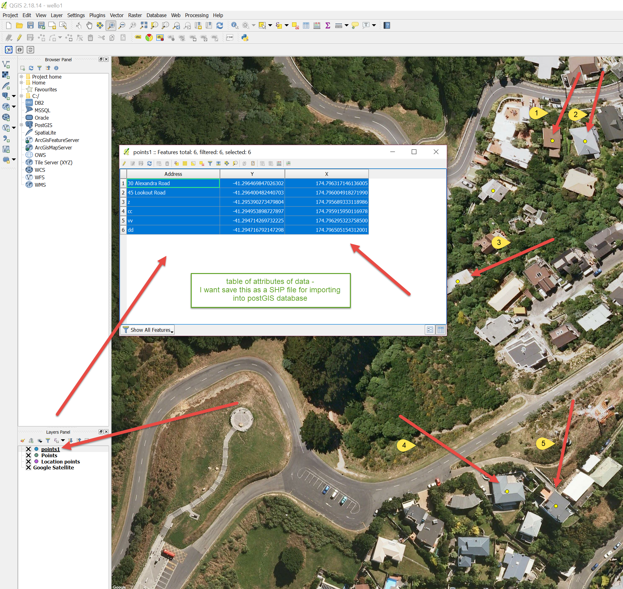
I decided to look at the GIS ( Geographic Information System) component of OpenMAINT. I decided to test this initially on my PC. To date, I have not been able to activate the GIS component. I am stuck with the following error: Call: services/json/schema/setup/saveconfiguration ————————————————— Error: org.cmdbuild.exception.ORMException: ORM_POSTGIS_NOT_FOUND at org.cmdbuild.exception.ORMException But the steps below may
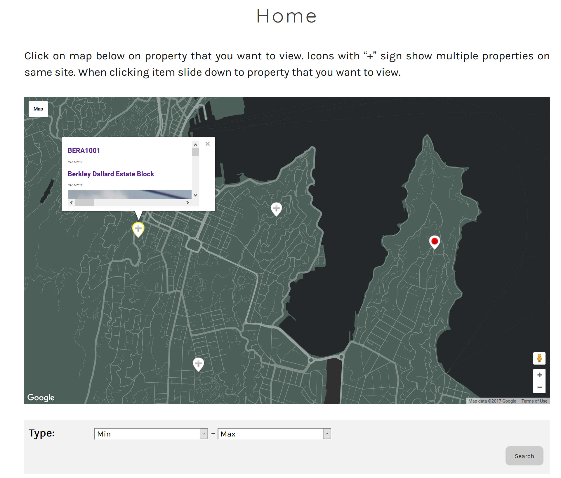
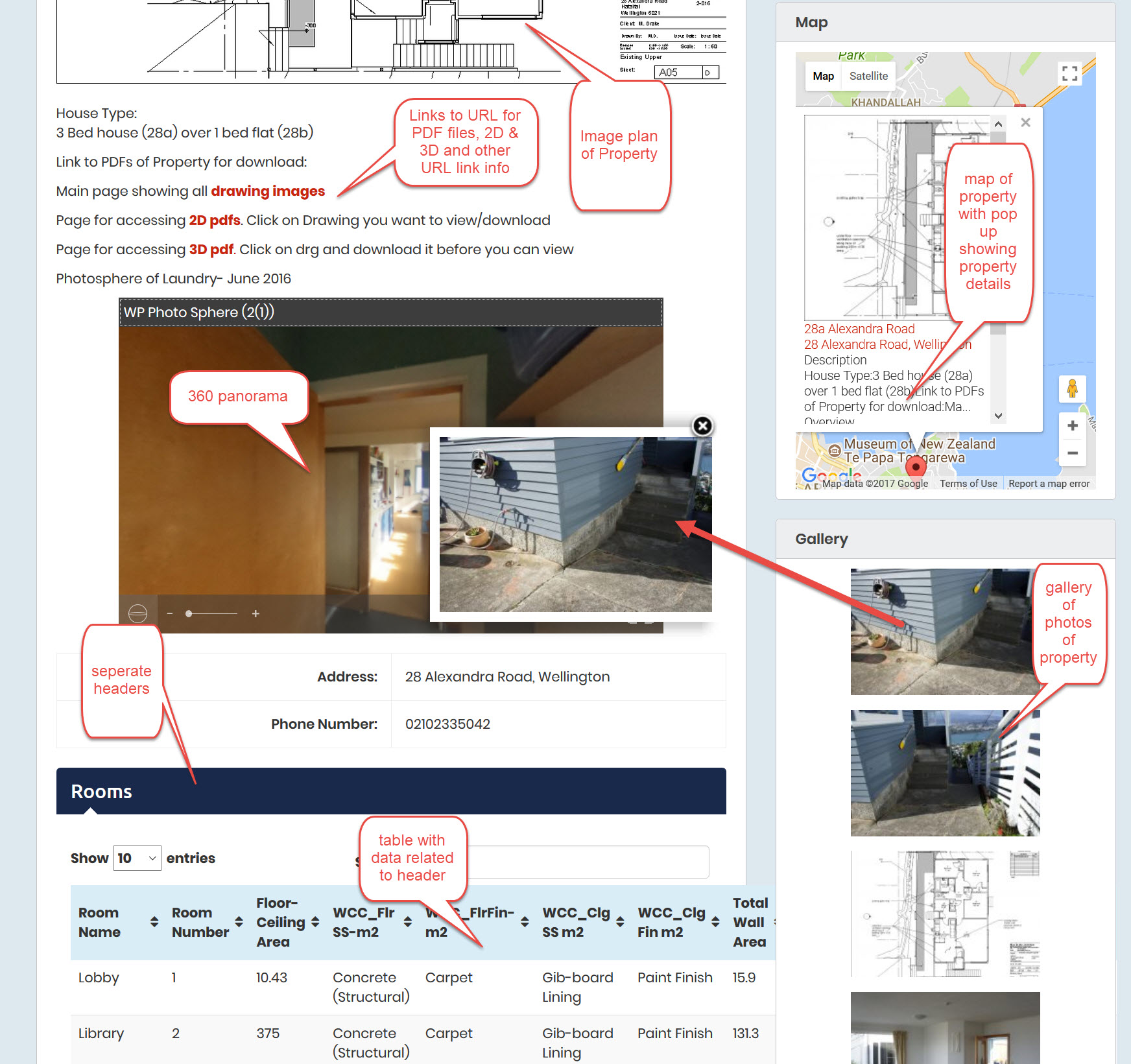
The idea was to alter an existing Real Estate Site to a Asset Property Management Site in WordPress using free Templates/plugins. Go to apriori.ml to view the demonstration site. This has now evolved a bit as I can see extra things that I think I want to do and add to the site. From the
The demonstration site, which uses examples of different free plugins to demonstrate different features, can be found at apriori.ml. Looking at the WordPress themes (free ones of course) I saw there were quite a lot of real Estate Themes and Plugins and I wondered if you could adapt one of these to be a property
Hi All, Forum tab next to Home on menu bar. Or HERE I have noted that there seems to be quite a bit of interest from you out there on my openMAINT setup and configuration blogs. Obviously you are interested in the product and interested in getting instances of your own up and running. I
Interactive exploration of Data Tableau Public After the first static processes of expressing Condition over time on a map Part 1 I explored using Tableau Public for creating an interface for users to explore the data. The House Conditions in Tableau demonstration allows for users to explore the data in a number of ways and
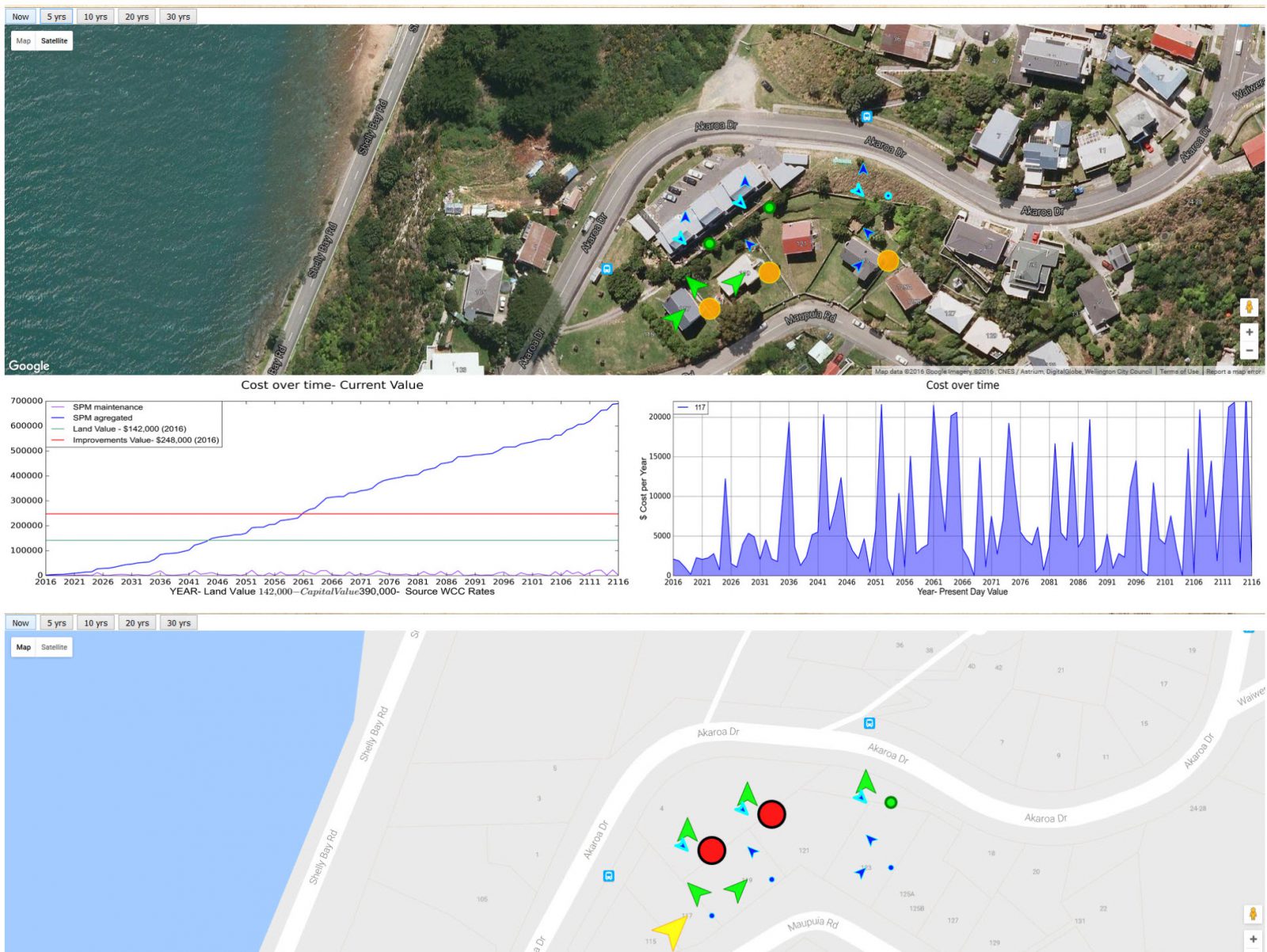
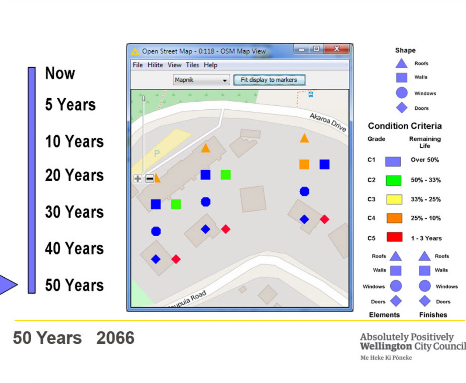
Visualization of geographic building elements Using the same dataset as the Revit internal Condition over Time , I wanted to explore how it could be used geographically to describe the diverse buildings and their locations around the city. QGIS One of the first things was to plot the buildings on a map. For that I
Google Earth allows you to place your 3D models onto the Earth.(Prior to 2012 they allowed these models to be uploaded publicly but have since stopped that, so there are a number of 3D models inside Google Earth). From Revit you can export the model using the Free Lumion Collada Exporter. These can then be