Visual Asset Strategic Tools. Capture Building Information for Building Life Management. Open Source/Low Cost Technology Solutions for you to control your buildings
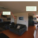
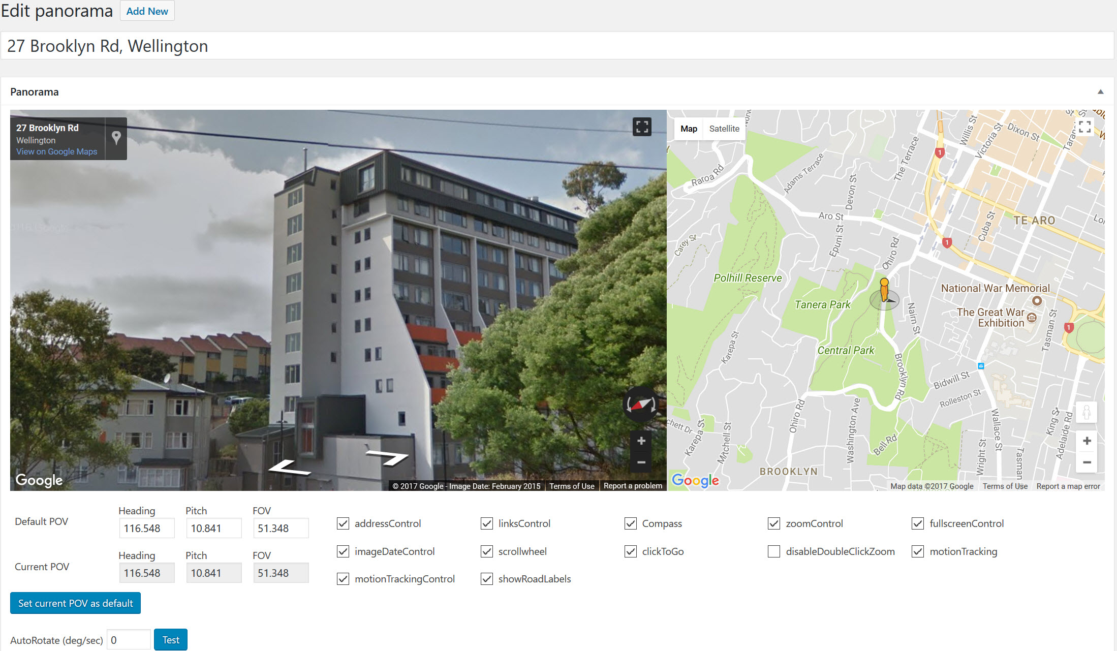
The new photo sphere viewer by Jeremy Heleine allows you to put Markers on your Panorama . See demo here. I think that is pretty cool and I wondered if you could make them into Hyperlinks to link other panoramas to make a virtual tour. So I did some tests. My previous way to be
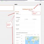
After trying and writing post about EpiCollect5 I decided to look at another data collection tool, Open Data Kit (ODK). A brief overview of it in video below: This has some strengths and weaknesses over EpiCollect5. Weaknesses: Only Android App, not Apple (but since there are lots of cheap Android mobiles this is not a
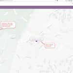
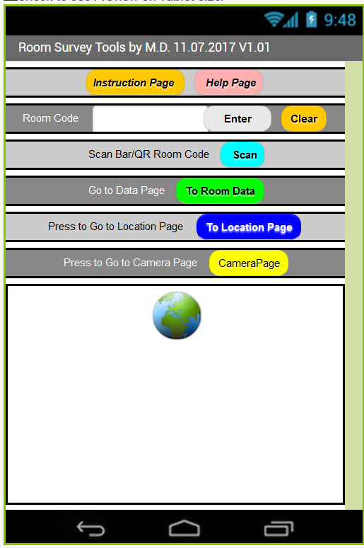
I had a couple of attempts at creating a mobile phone app for surveys. See this post and this one. I got distracted by the CRUD process and let it rest for a while. Whilst looking for some Python Mapping tools, I came across this article regarding capturing GPS data and was taken with the
Modern Asset & Facilities Management use information about their assets to plan and maintain them in a Fit for Purpose state so that they can fulfill their space function to maximise their asset value. To do this you require information about the buildings so that you can use predictive tools to: Effectively budget to maintain
I see panoramic 360/180 pictures as an extremely useful tool for Facility Management. As an Architect who goes to site to capture information on existing buildings and sites, the frustration of having a photo cut off just where you wanted to see something just outside the normal picture frame, usually requiring a 2nd visit to
Hi All, Forum tab next to Home on menu bar. Or HERE I have noted that there seems to be quite a bit of interest from you out there on my openMAINT setup and configuration blogs. Obviously you are interested in the product and interested in getting instances of your own up and running. I
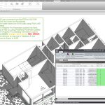
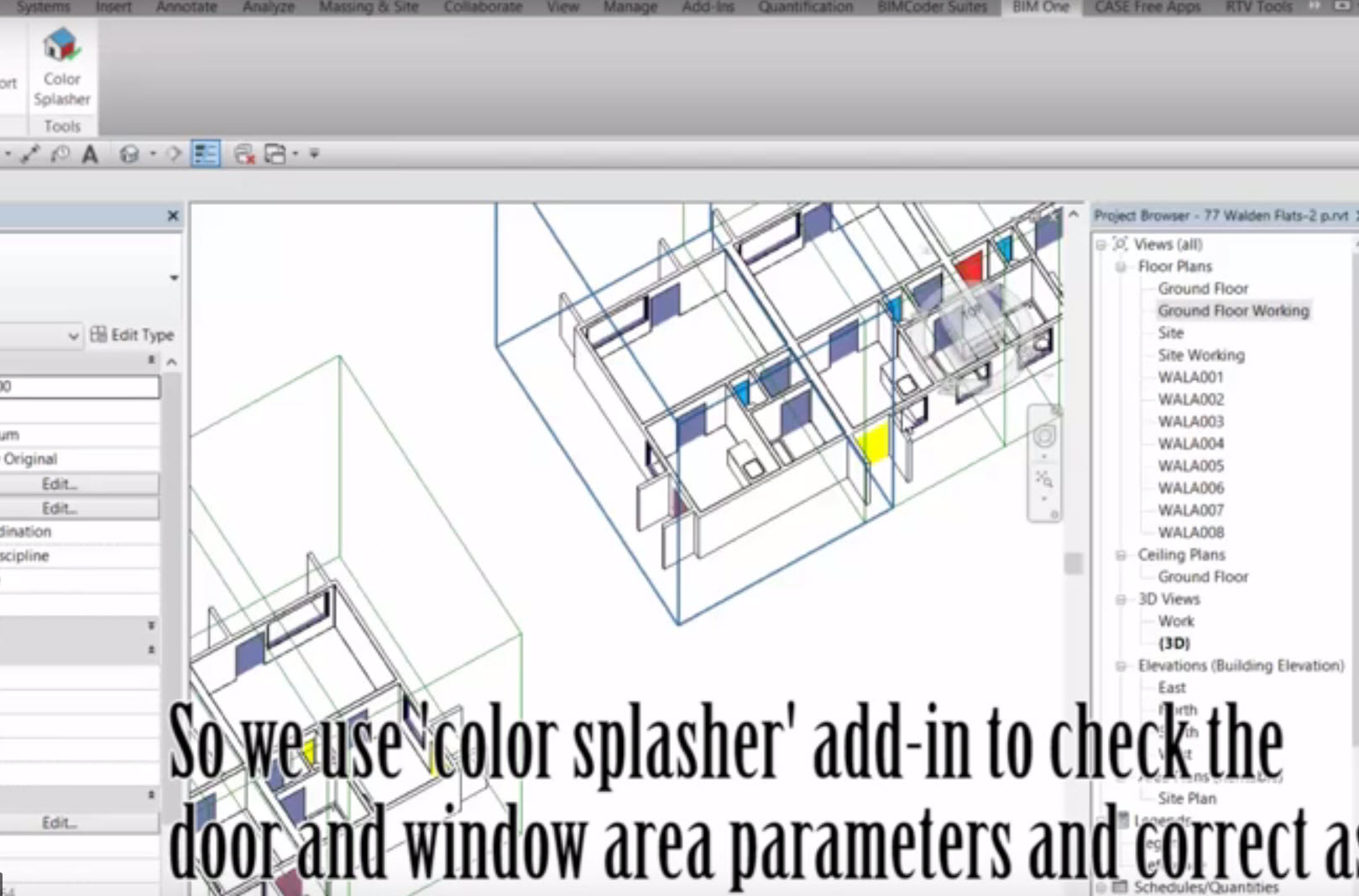
This Survey uses Revit Model Measures to Compare against SPM Surveyed Data of 26 identical apartments. The Survey This is comparison of Duncan Terrace Flats A01 to A26 which are all similar,( some handed so bathroom/kitchens are flipped- see plans below). Each individual flat was surveyed by one of 5 surveyors who had a group
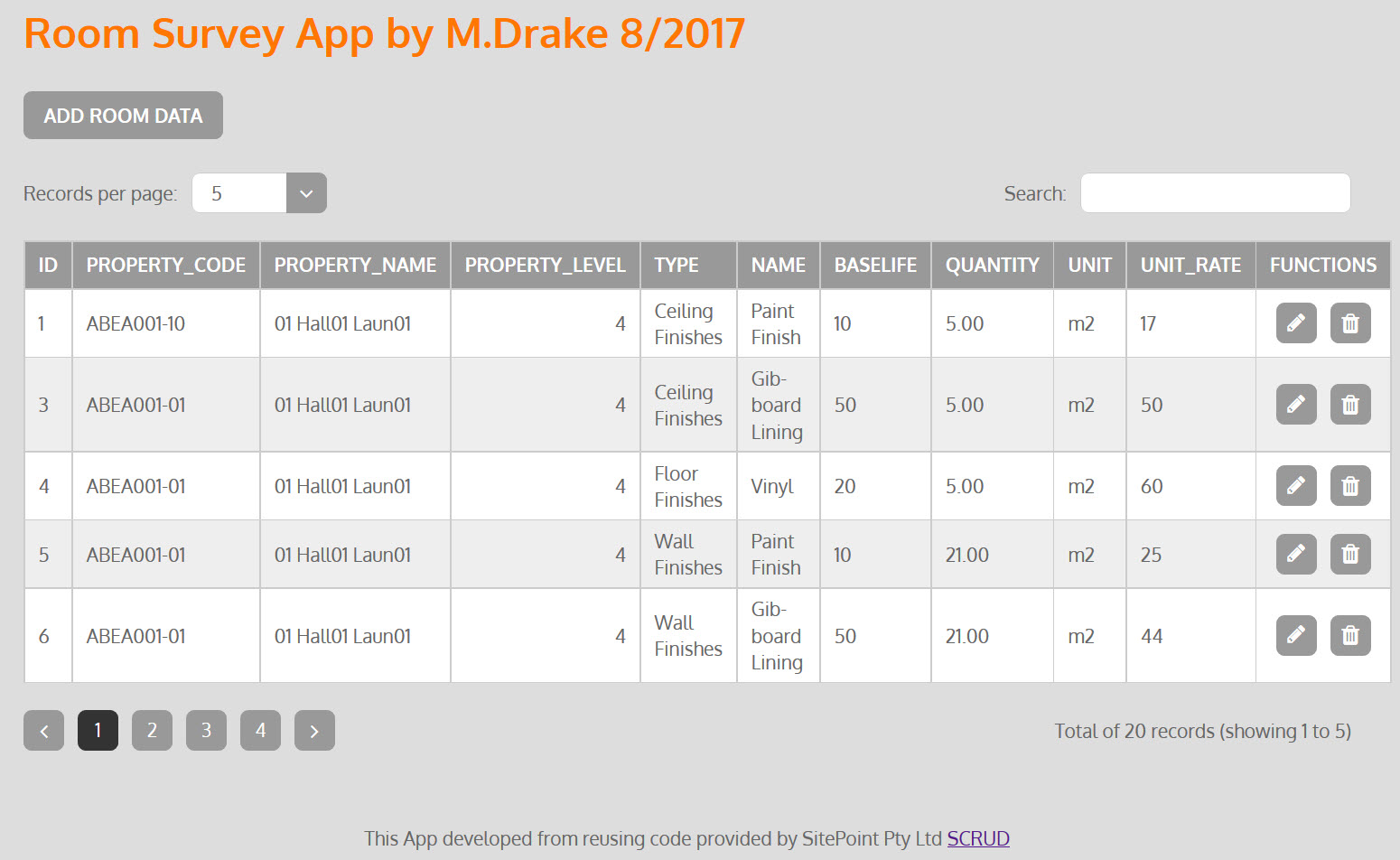
Where we left off at end of Part 1. Part 2. How to get the search tool working. I tried to code myself, adding to what I had already achieved, but spent a day going around in circles. Then I came across this : Weblesson Datatables Jquery Plugin with Php MySql and Bootstrap. This was
Of all the Asset/Facility Management visualisation development tools I have been exploring, I felt the need to develop an app that can be used on mobile devices for site & room surveys. This is the one item that a lot of commercial FM systems offer. Even OpenMaint you have to have a subscription for using
Capturing information on existing assets is a challenge Wellington City Council (WCC) has over 2200 social housing units and so getting good information on them in a consistent manner was a challenge. They undertook a condition survey with surveyors on the properties. It took the surveyors on average 4 hours to survey each unit. There