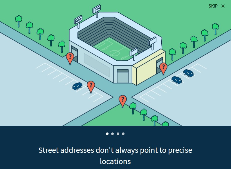
Geographic location for postal services, lat/long, what3words & pluscode
I’m interested in maps and locations. I recently heard of the what3words as a method of finding locations where there were no postal street addresses and then started looking into the whole topic and found it quite fascinating. Google has PlusCodes.
The idea of getting something delivered to you and also finding locations in areas where there is no formal mapping of addresses, as in squatter camps or in remote areas. PlusCodes talks about addresses needed for voting, getting a bank account and other necessary services, so having a valid address is important.
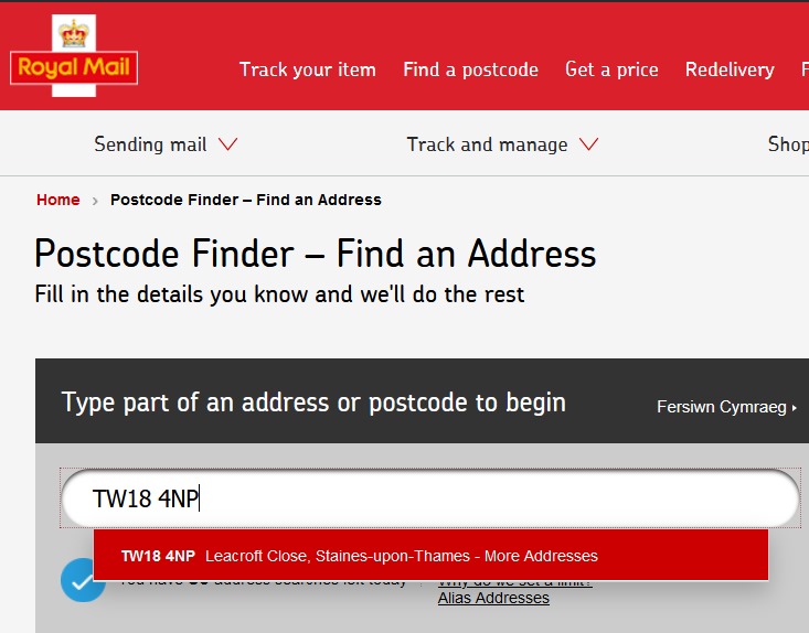
When filling out online forms a lot ask for Zip codes, a US method of locating addresses as postal codes, in the UK its Post Codes and I can still remember the one for mty parents house, TW18 4NP.
Zip codes US
A ZIP Code is a postal code used by the United States Postal Service (USPS). Introduced in 1963, the basic format consisted of five digits. The term ZIP is an acronym for Zone Improvement Plan; it was chosen to suggest that the mail travels more efficiently and quickly when senders use the code in the postal address.
UK post codes
Postal codes used in the United Kingdom are known as postcodes. They are alphanumeric and were adopted nationally between 11 October 1959 and 1974, having been devised by the General Post Office (Royal Mail).
The structure of a postcode is two alphanumeric codes, the first having between two and four characters and the second, three characters. First, one or two letters indicate the postcode area, followed by one or two digits signifying a district within that area. This is followed by a space and then a number denoting a sector within said district, and finally by two letters which are allocated to streets or sides of a street. Postcode areas are often named for a major town or city—such as B for Birmingham—but may also be geographic in nature—such as HS for the Outer Hebrides.
General Post Codes
So used to help identify quickly areas mail to go to, so speeding up sorting of mail. This could be further automated using Barcodes for machine reading for getting machines to sort mail.
So a method to locate areas, in US initially 5 digits then they tried to add another 4 to make it more accurate.
With globalisation and being able to order online, in more remote areas where addresses were a bit more arbirary improved methods needed to be looked at to find locations. If someone orders stuff from you, you’ve got to deliver it or else you start getting a lot of negative feedback. So finding methods to identify locations for remote villages were explored. One method was the what3words
What3Words

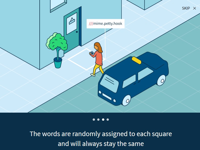
From wikipedia :What3words is a geocode system for the communication of locations with a resolution of three metres. What3words encodes geographic coordinates into three dictionary words; the encoding is permanently fixed. For example, the omphalos of Delphi, believed by the ancient Greeks to be the centre of the world, is located with ///spooky.solemn.huggers. What3words differs from most other location encoding systems in that it displays three words rather than strings of numbers or letters.
What3words has a website, apps for iOS and Android, and an API that enables bidirectional conversion between what3words addresses and latitude/longitude coordinates. As the system relies on a fixed algorithm rather than a large database of every location on earth, it works on devices with limited storage and no Internet connection. According to the company its revenue comes from charging businesses for high-volume use of the API that converts between 3 words and coordinates; services for other users are free of charge.
Design principles of what3words
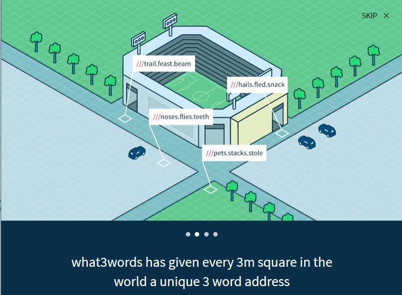
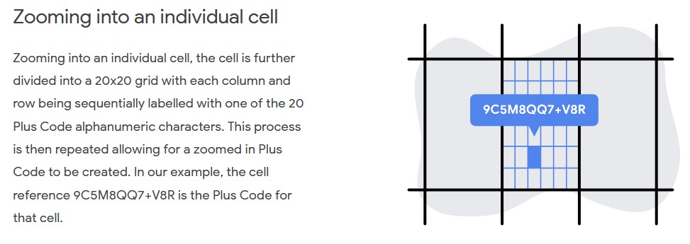
What3words uses a grid of the world made up of 57 x1012 squares of 3 metres by 3 metres. Each square has been given an address composed of three words. The addresses are available in 43 languages according to the what3words online map (as of May 2020), and the addresses are not translations of the same words.
Each what3words language uses a word-list of 25,000 words (40,000 in English, as it covers the sea as well as land). The lists have been manually filtered to take account of word length, distinctiveness, frequency, and ease of spelling and pronunciation, and to reduce potential for confusion, and remove offensive words.
The what3words algorithm distributes similar-sounding three-word combinations around the world to enable both human and automated error-checking. The result is that if a three-word combination is entered slightly incorrectly and the result is still a valid what3words reference, the location will usually be so far away from the user’s intended area that the error will be immediately obvious to both a user and an intelligent error-checking system.
The what3words system uses a proprietary algorithm in combination with a limited database; the core technology is contained within a file of about 10 MB. The database is used to assign more memorable words to locations in urban areas. What3words originally sold “OneWord” addresses, which were stored in a database for a yearly fee, but this feature has been cancelled.
The main claimed advantages of what3words are memorability, error-detection, unambiguous nature of words for most everyday and non-technical uses, and voice input.
Criticism of what3words
Supporters of open standards criticise the what3words system for being controlled by a private business and the software for being patented and not freely usable. That similar addresses are purposely far away from each other is seen by some as a disadvantage.
The company has pursued an assertive policy of issuing copyright claims against individuals and organisations that have hosted or published files of the what3words algorithm or reverse-engineered source code that replicates the service’s functionality, such as WhatFreeWords. This has extended to removing comments on social media which refer to unauthorised versions.
Another comment is about adjacency of words. As they are not ordered an adjoining tile 3mx3m would have a completely different set of 3 words, so you cannot find any lofgic of location from any of the words. This may be a pro or a con. The pro arguement ids that if you have the address wrong it will show a location so far away as to be absurd.
Also, itt is not supported on Open Street Maps as it is a proprietary programme. OSM wiki article what3words.
WhatFreeWords told to take down open source equivalent
A group of developers, who wish to stay anonymous, developed and released a free and open source implementation of the what3words algorithm under the name WhatFreeWords.[31] They provided implementations of the algorithm in JavaScript, Python, Go, and Rust, all being released under the CC0 license.[32] The whatfreewords.org website was subsequently taken down following a Digital Millennium Copyright Act (DMCA) take-down notice issued by What3words. A reverse-engineered encoding scheme and open source implementation was available on the website whatfreewords.net.
Parody
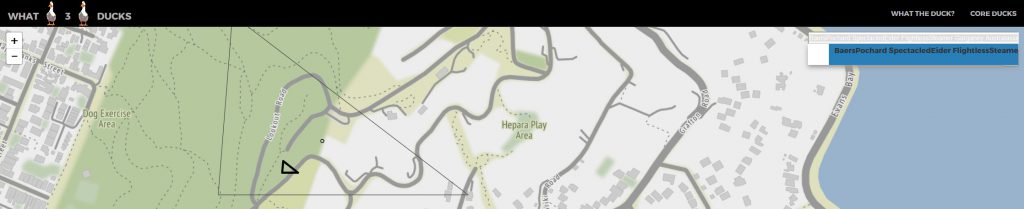
The site has been parodied by others who have created services including What3Emojis using emojis, What3fucks using swear words [seems to have been taken down but an article on Maps Mania here] and What3Numbers using OpenStreetMap tile identifiers. Also What3Ducks which uses triangles and OSM.
Comment on what3words
The fact that its a proprioetary licence means the algorithm is not open and also they seem to harass others who use equivalent systems. You also have to use their app or browser page to find location, so is only accessible through their platform (for access to their algorithm or API). Why get locked down into their system when other Open Source Systems are available?
This is what makes the appeal of Plus Codes more attractive, currently incorporated into Google Maps, but it was designed as open source.
Plus Codes
From Wiki: The Open Location Code (OLC) is a geocode system for identifying an area anywhere on the Earth. It was developed by Google, and released late October 2014. Location codes created by the OLC system are referred to as “plus codes“.
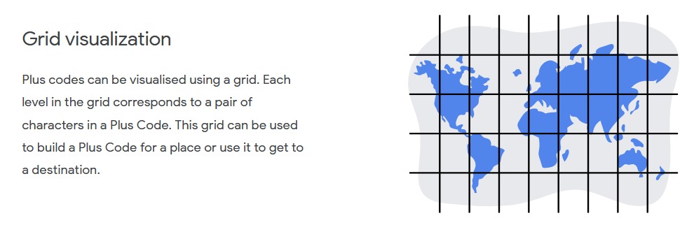
Open Location Code is a way of encoding location into a form that is easier to use than showing coordinates in the usual form of latitude and longitude. Plus codes are designed to be used like street addresses, and may be especially useful in places where there is no formal system to identify buildings, such as street names, house numbers, and post codes.
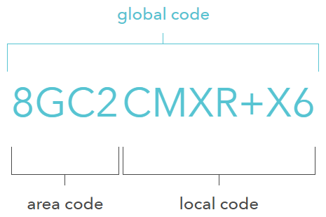
Plus codes are derived from latitude and longitude coordinates, so they already exist everywhere. They are similar in length to a telephone number – 849VCWC8+R9, for example – but can often be shortened to only four or six digits when combined with a locality (CWC8+R9, Mountain View). Locations close to each other have similar codes. They can be encoded or decoded offline. The character set avoids similar looking characters, to reduce confusion and errors, and avoids vowels to make it unlikely that a code spells existing words. Plus codes are not case-sensitive, and can therefore be easily exchanged over the phone.
Since August 2015, Google Maps supports plus codes in their search engine. The algorithm is licensed under the Apache License 2.0. and available on GitHub. Google states that plus codes are accepted as postal addresses in Cape Verde, parts of Kolkata, and the Navajo Nation.
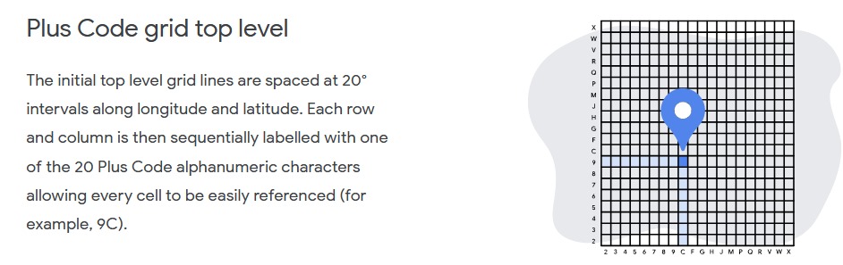
For a given plus code, the first four characters narrow down the area search to a grid of around 100 x 100 kilometers. The remaining 6-character code can help a person pin down to your exact location. It describes the area roughly of the size of a half basketball court, around 14 x 14 meters. An additional accuracy of up to 3 x 3 meters can be achieved.
You don’t need to use the first four digits of a plus code if you’re not searching an international location or someplace far off. The local code in such cases is combined with nearest city or town to make it simpler. For instance, if the place you want to find is a few kilometers away from London, you can use the local code of that place together with the city’s name, i.e. London.

Plus Code Specification can be found here.
There is also an article on Evaluation of Location Encoding Systems that
Using PlusCodes
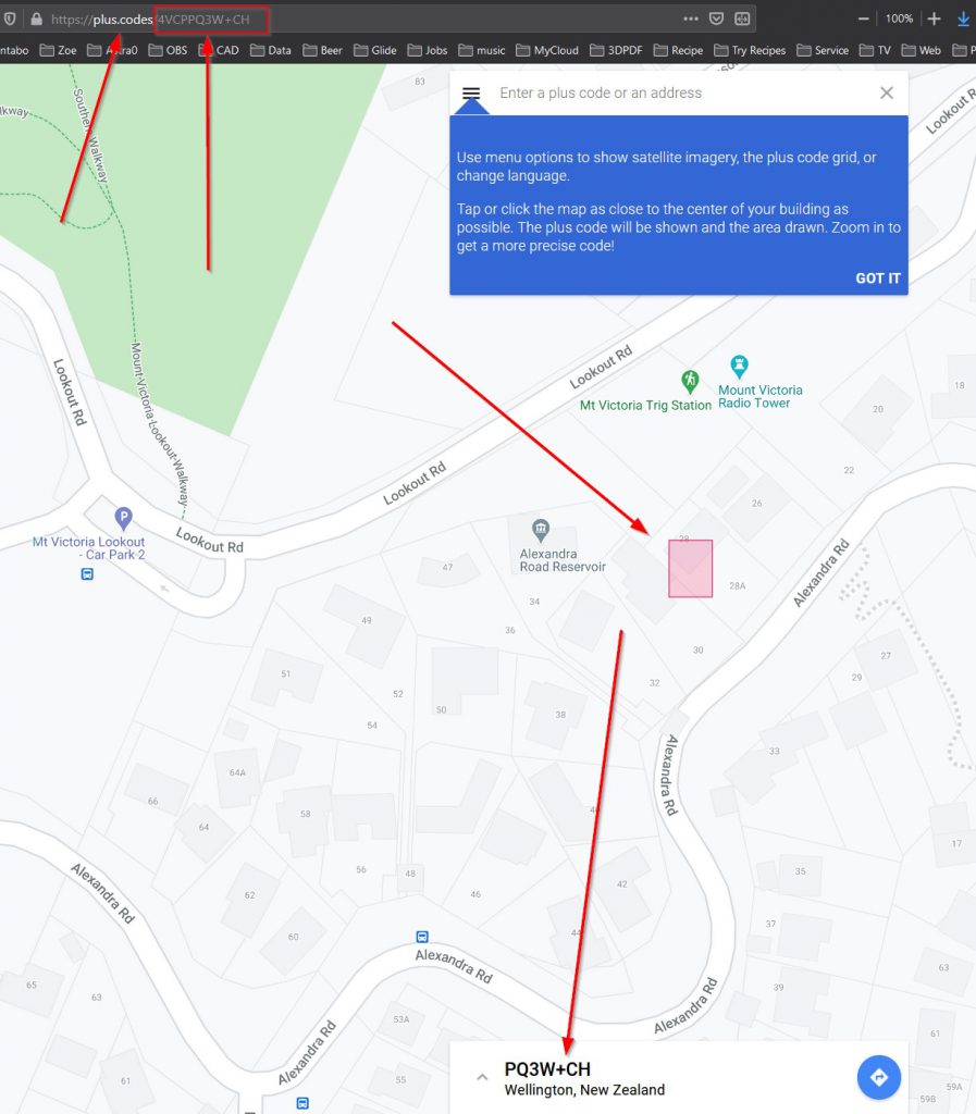
You Can go to: https://plus.codes/map and put in address and get a Plus Code for the location . You can also get the source code on Github and create your own API to make calls to, here.
4VCPPQ3W+CH Plus codes like this include an area code at the start, and don’t need a town or a city. Places that are far from a town or city might have to use these longer codes. It gives it as PQ3W+CH Wellington NZ in map below.
-41.296437,174.796438 latitude & longitude
28 Alexandra Road, Hataitai, Wellington 6021, New Zealand actual street address.
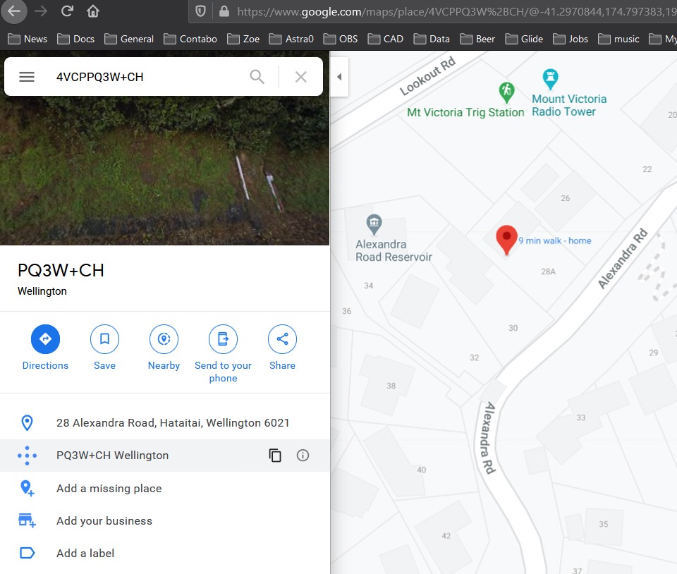
In Google Maps you can just put in Plus Code and it will show you location:
A good article from the Github repository on PlusCode and its imperfections here.
Comment on Plus Code
I like the open source nature of Plus Code. A personal bias, especially for something global that assists people who are least advantaged in accessing technology and wealth.
The digits are far less easy to remember than a 3 word address but they are of the same sort of length as a telephone number which were initially designed to be remembered by people for commonly used telephone numbers, but they do take more effort to remember. PQ3W+CH Wellington NZ a 4 + 2 number and town is easier than an 4VCPPQ3W+CH eight plus 2 number (10 digits and the plus sign) but my telephone mobile number is 11 digits long and I remember that.
There is the issue of using Google Maps, it not being used in OSM (see discussion here), apparently its in OSMAnd (offline OSM app), but the comment on it standing the test of time is a valid one.
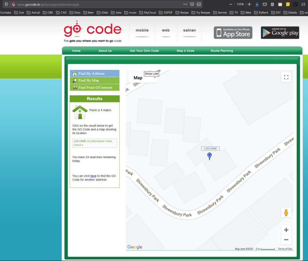
Go Code Ireland and Addressing the Unaddressed
This is an interesting lead up and use from Plus Code. The Go Code for An Post in Ireland led on to an Irish NGO called Addressing the Unaddressed in developing and putting up Plus codes in Kolkuta (see video at start)